Simple yet useful Mobile Apps

Mapnitude has developed a range of GIS and mapping applications, which offer a variety of features and functionality. Our tools are designed to be user-friendly and easy to use, and can be used for tasks such as determining coordinates, finding elevations, and calculating distances. In addition to GIS and mapping applications, We also offer other tools such as a barcode reader and a commodities price app. The goal of our company is to create simple and useful apps that can help people in their daily lives.
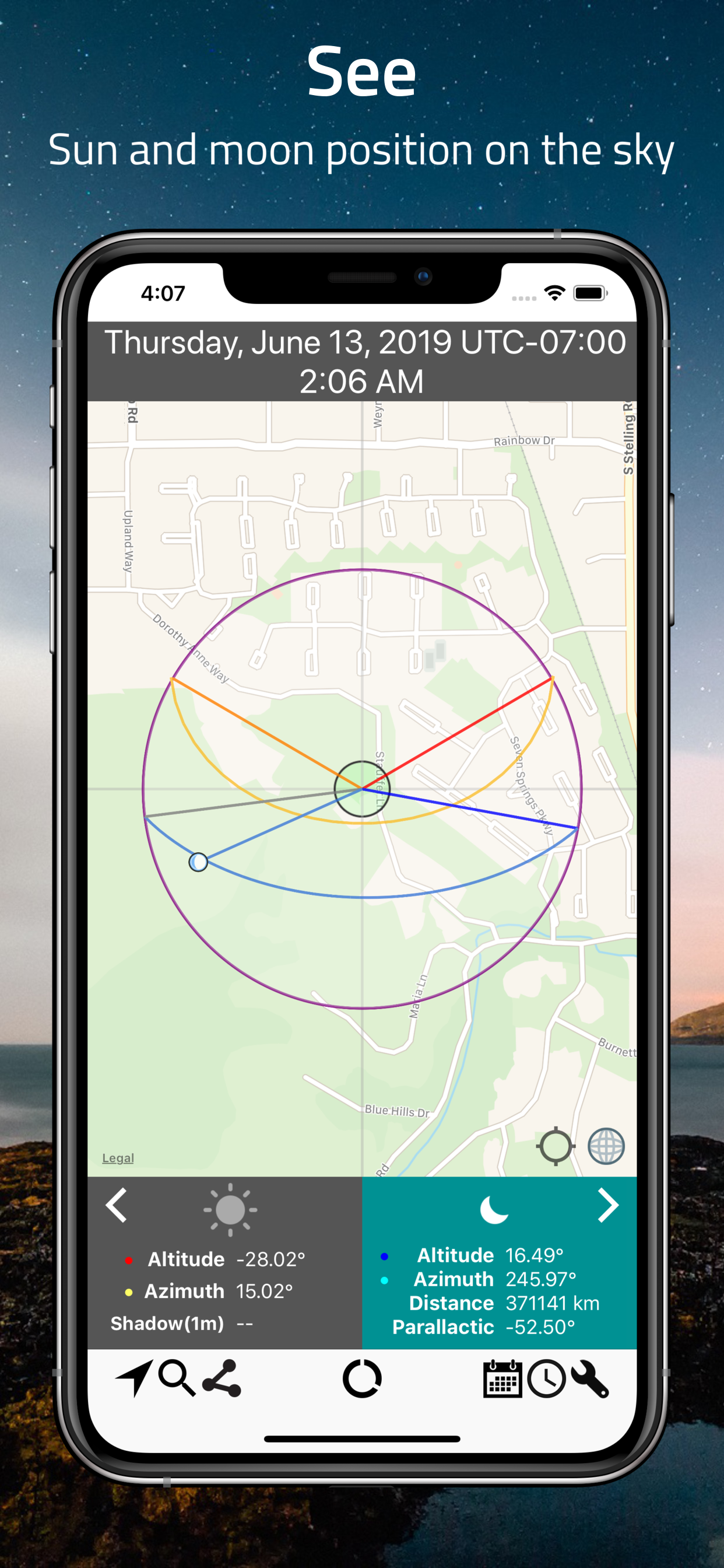
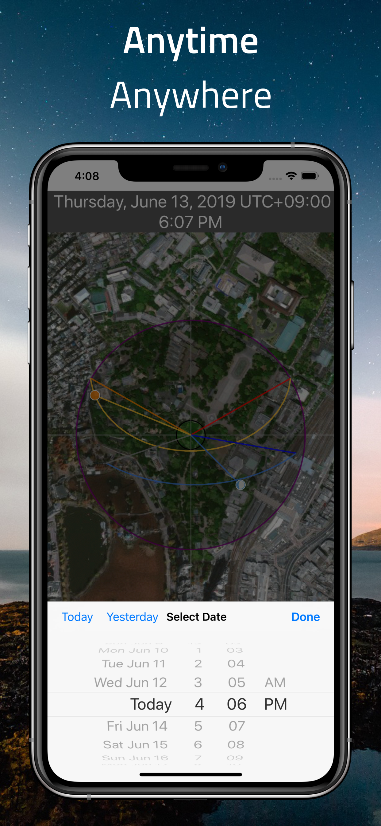
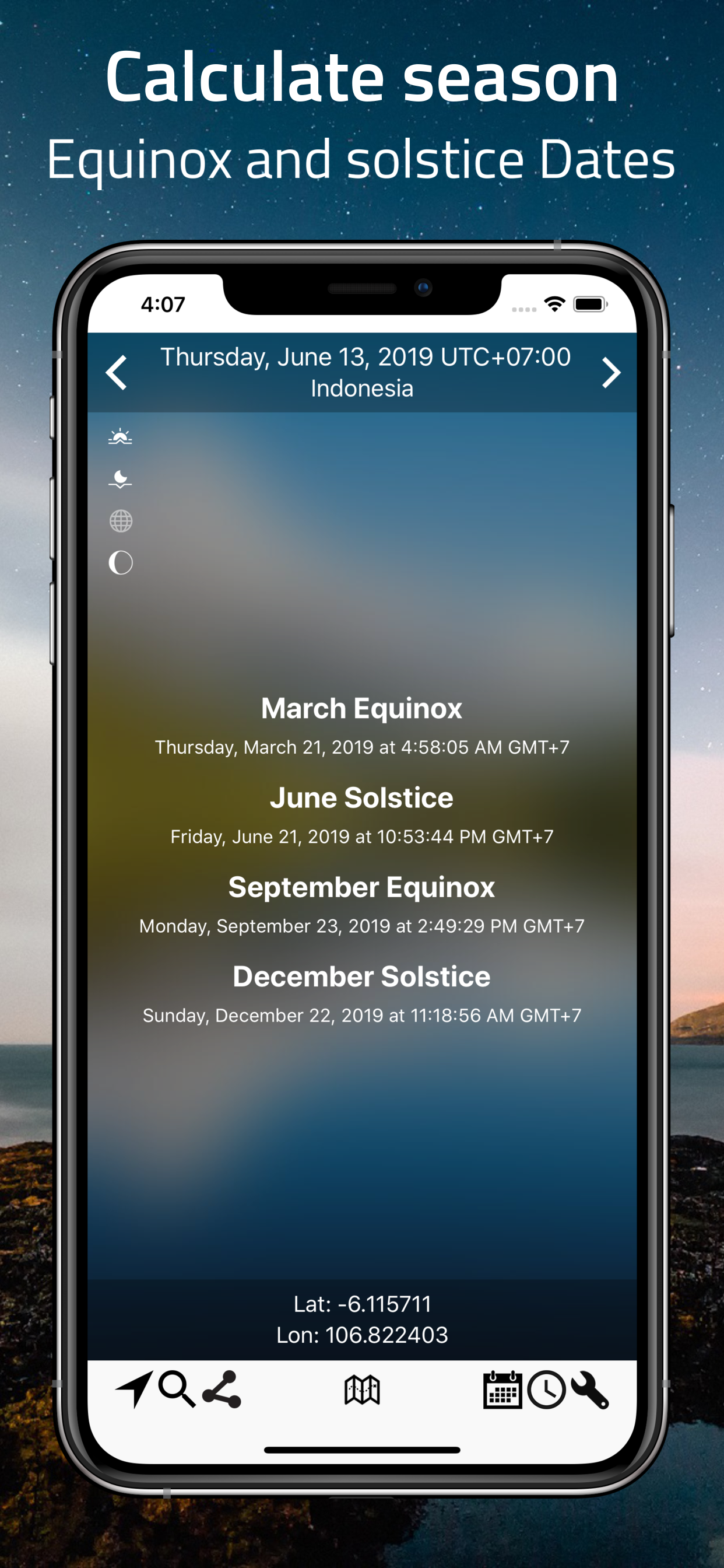
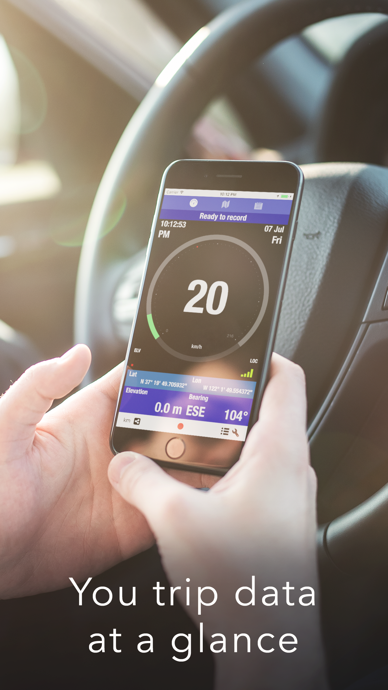
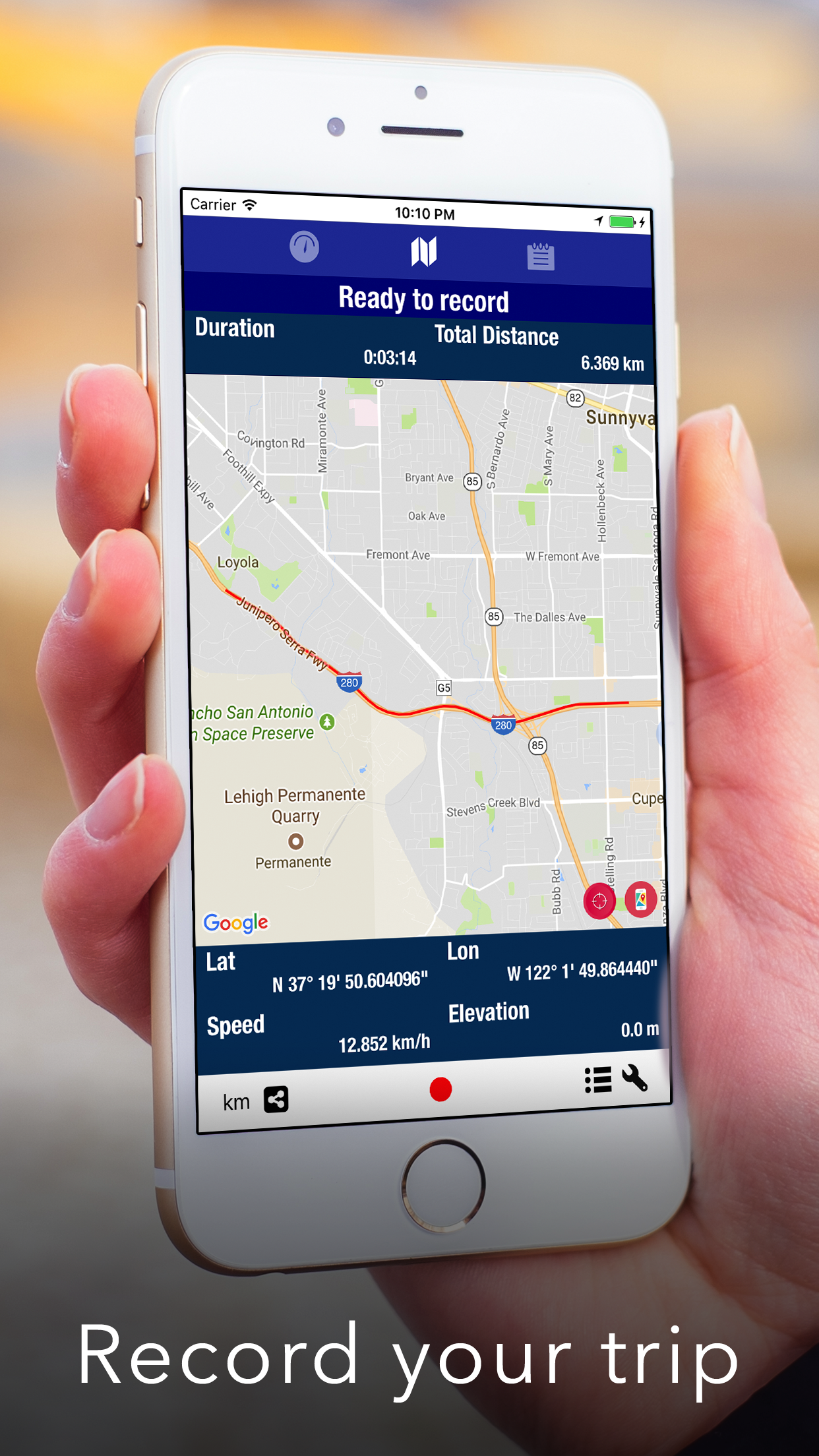
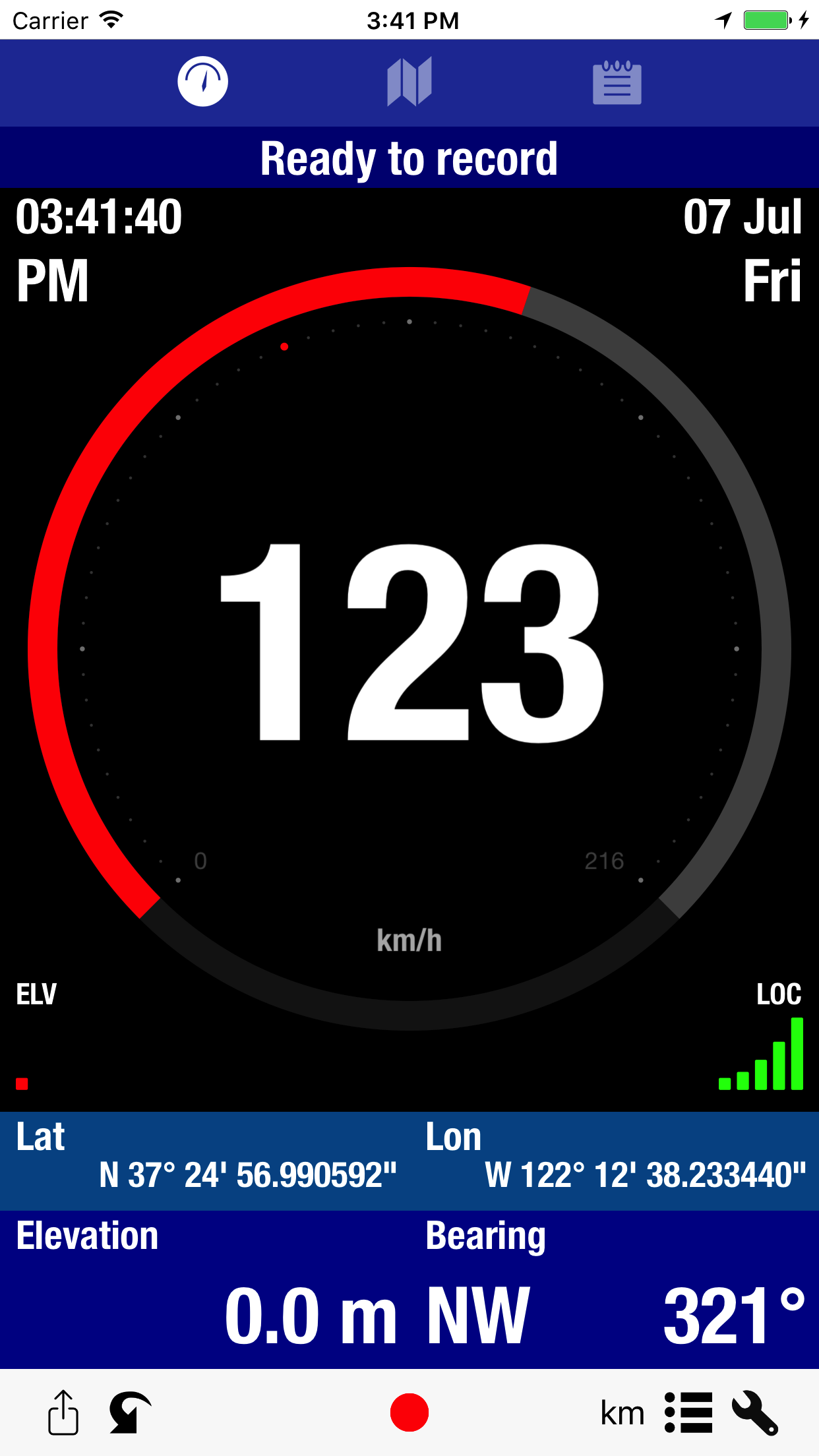
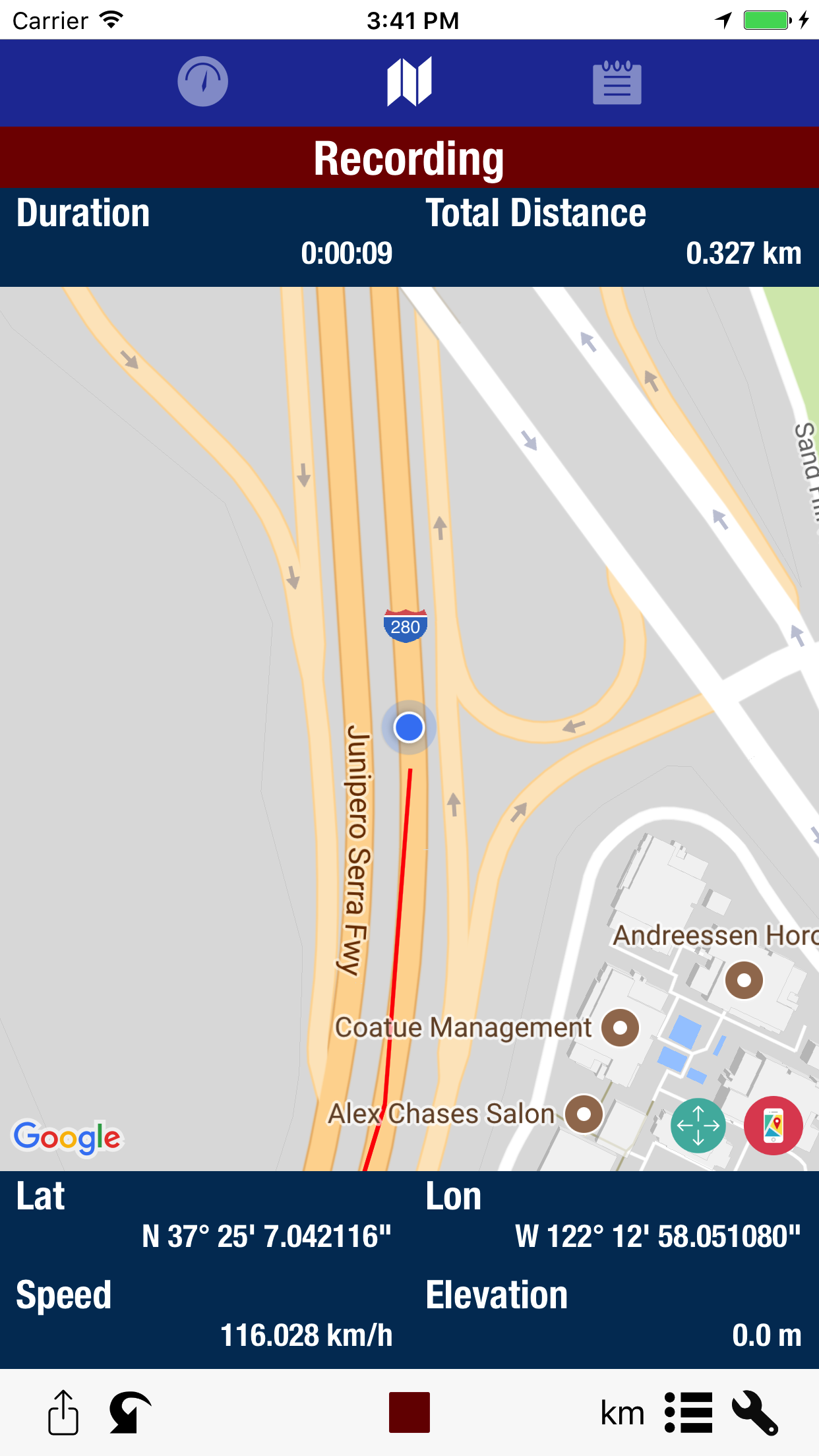
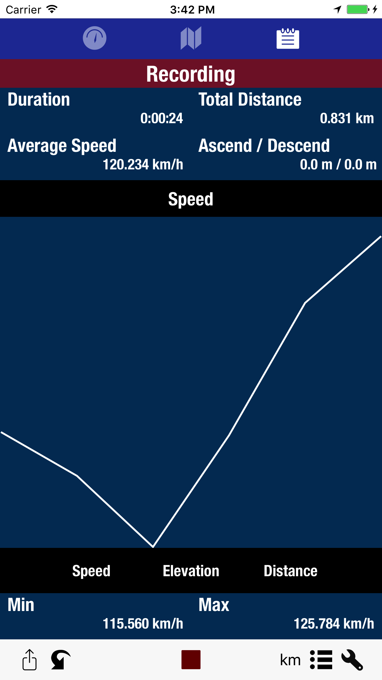
 

Map utility

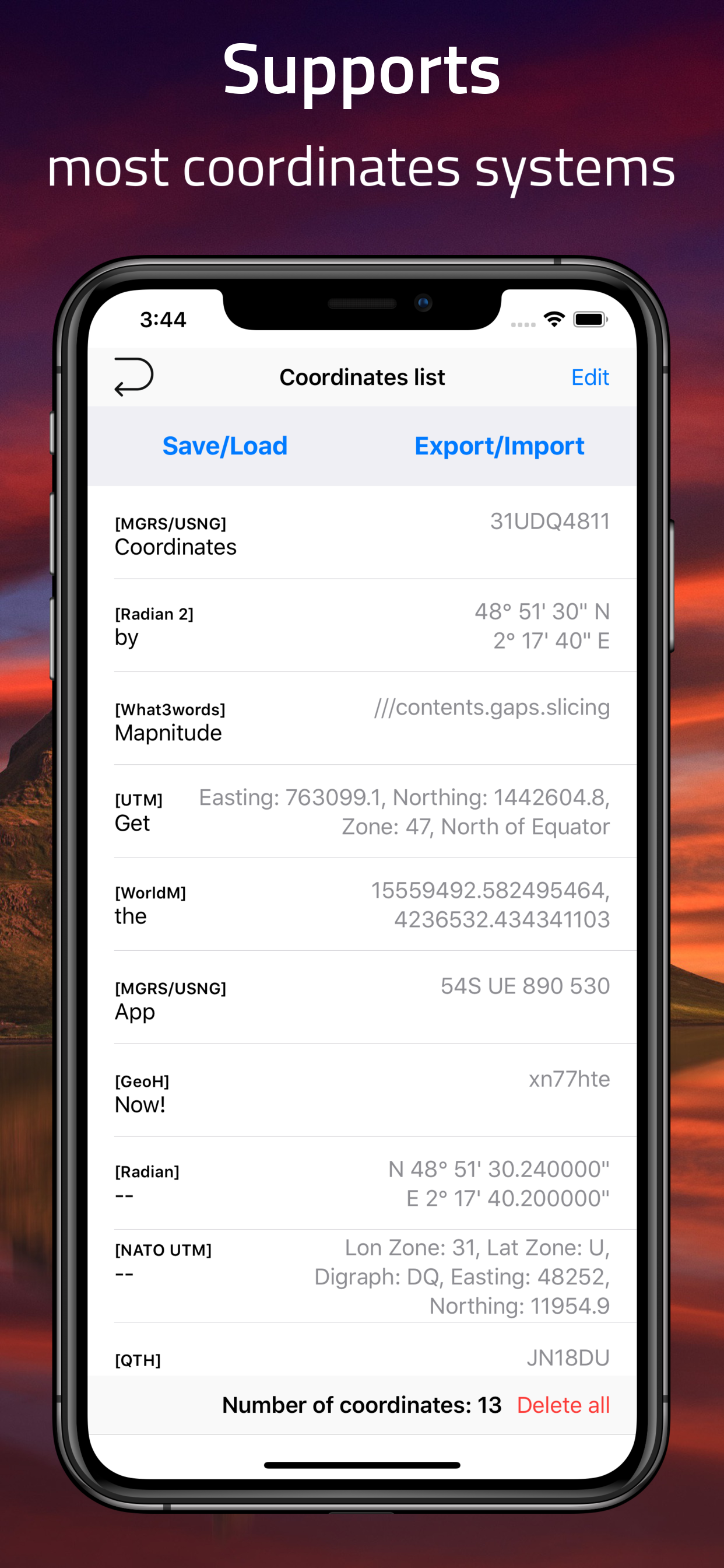
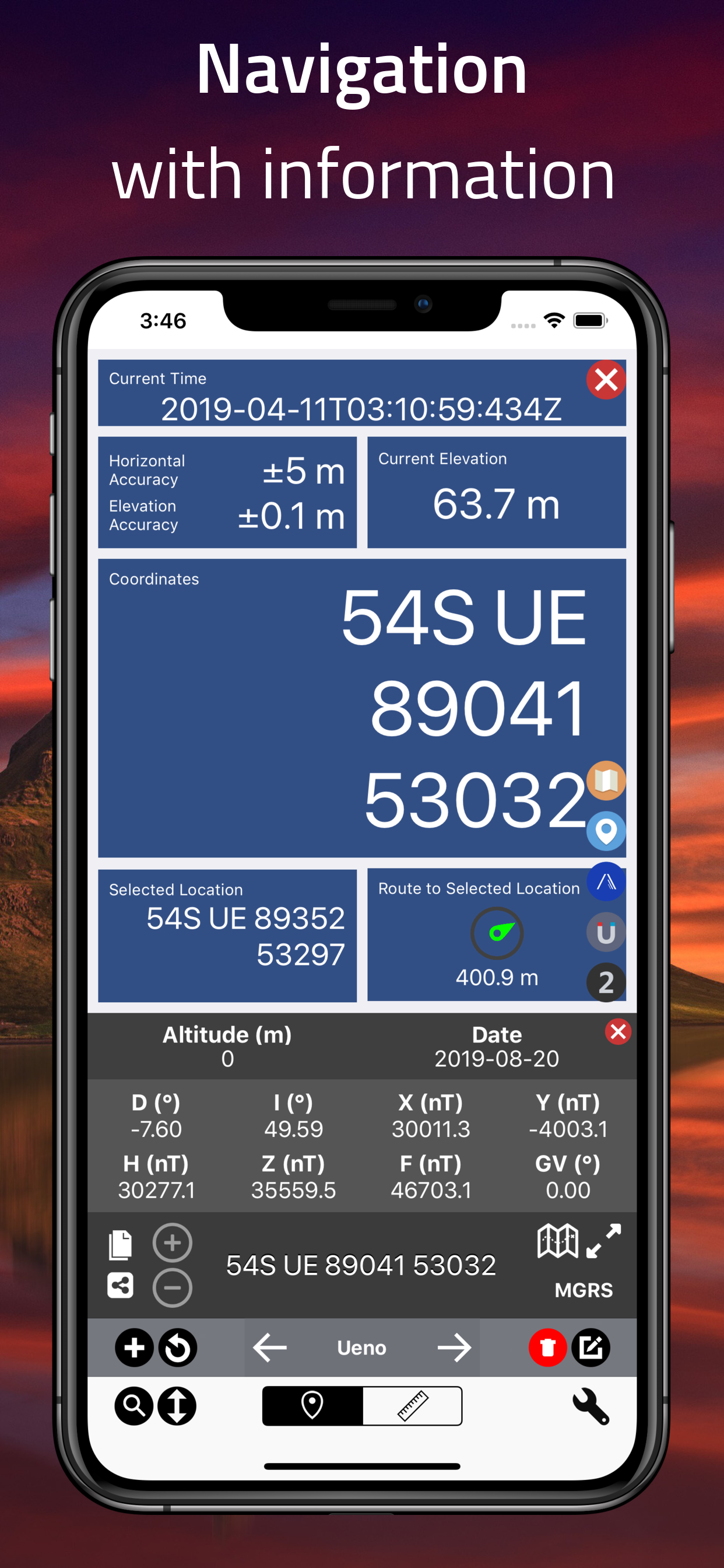
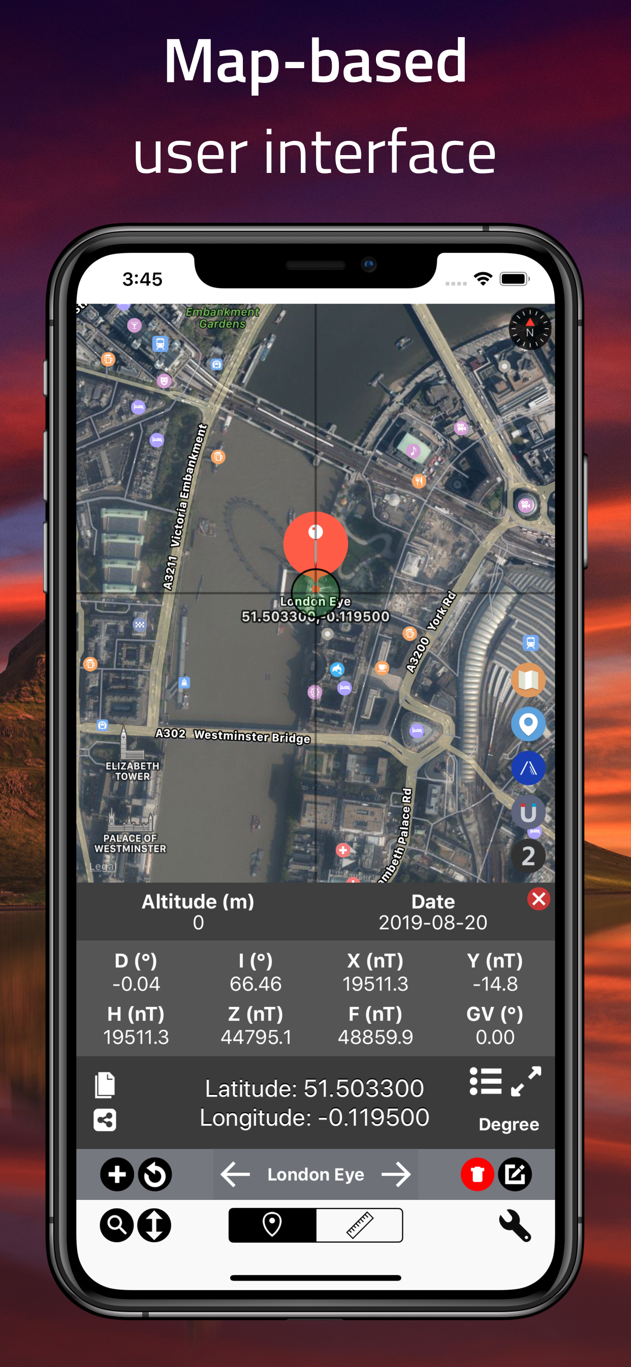
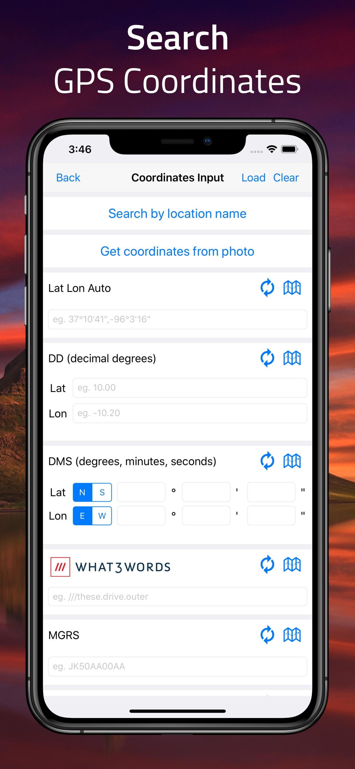
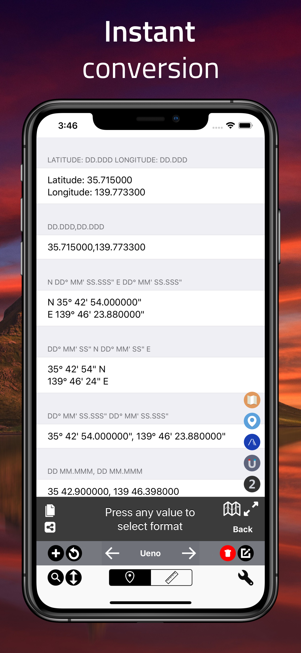
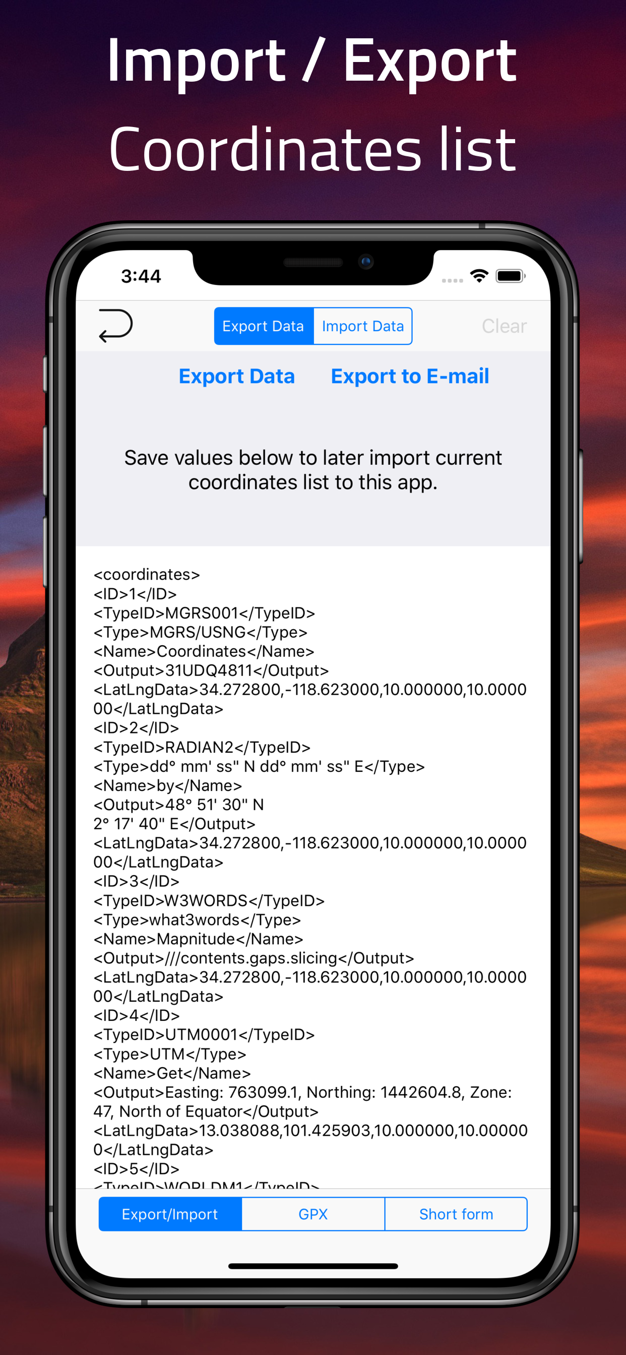
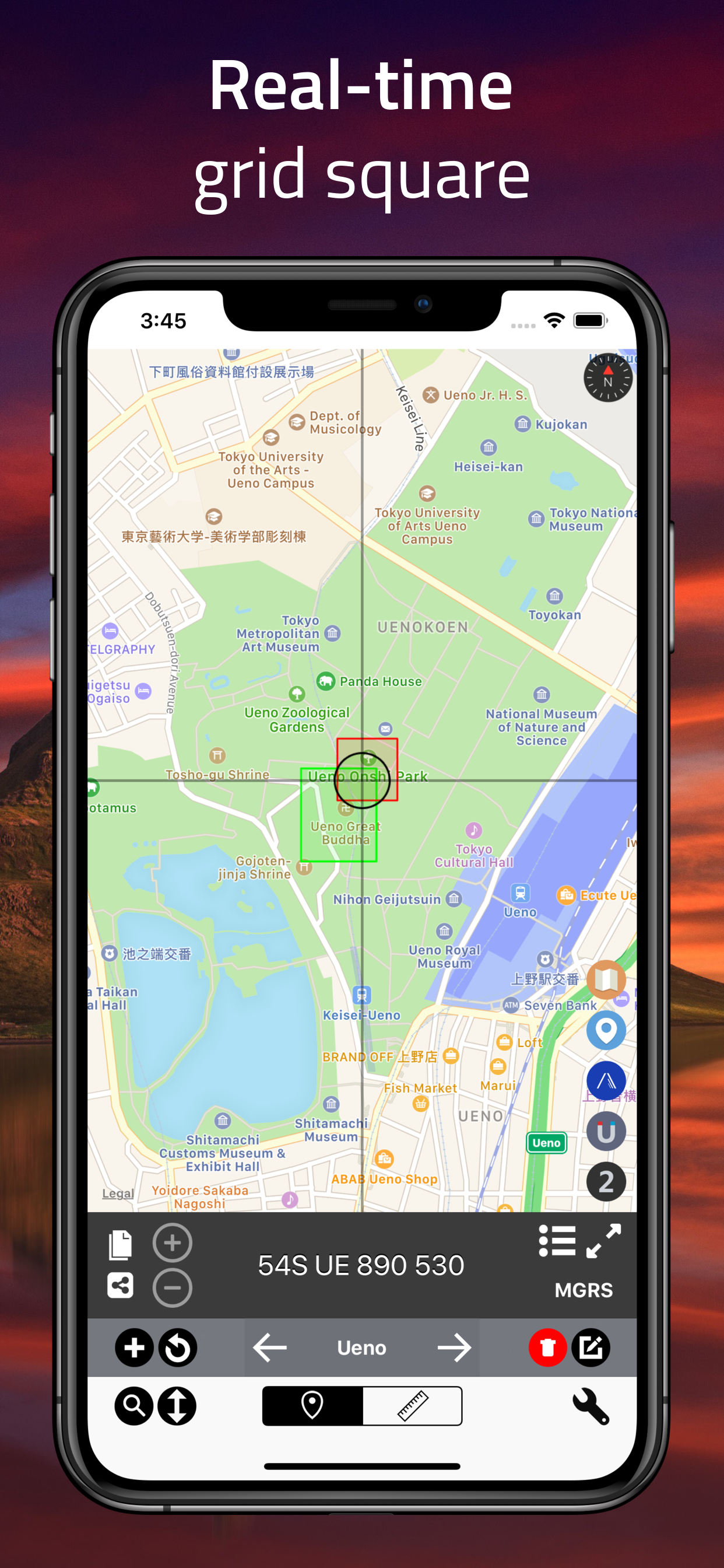
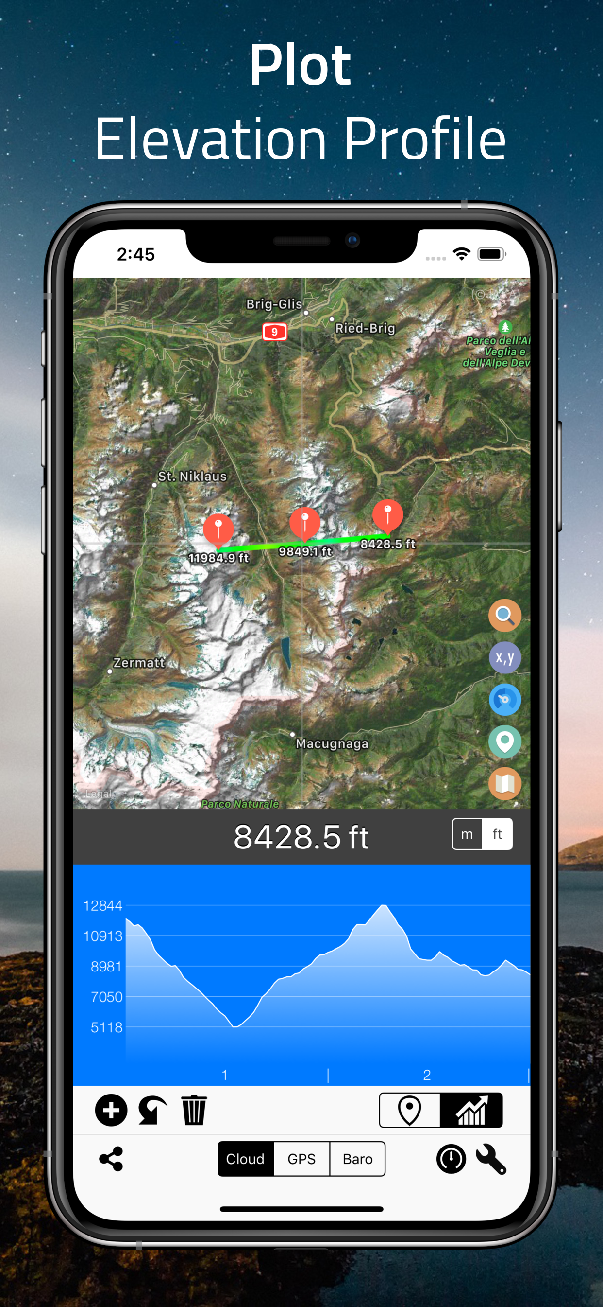
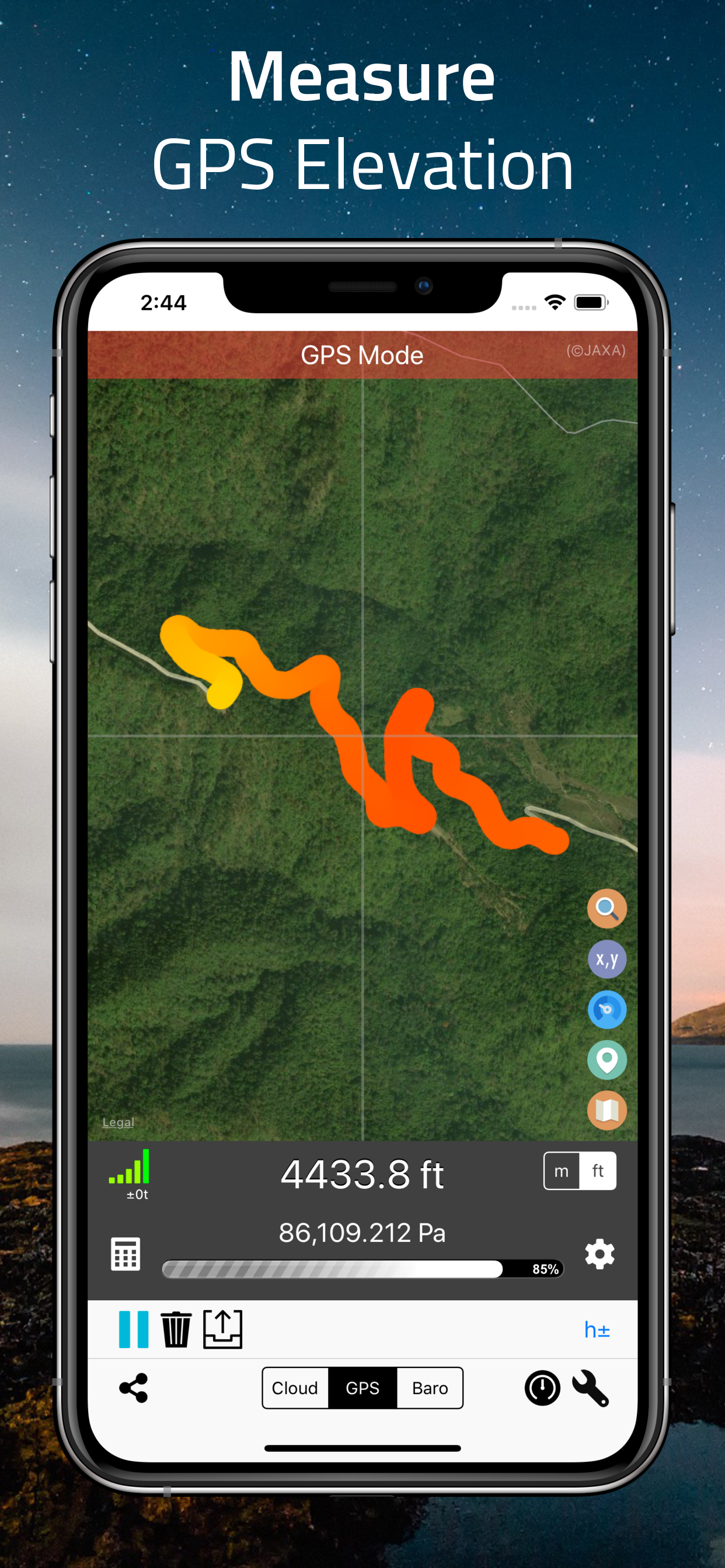
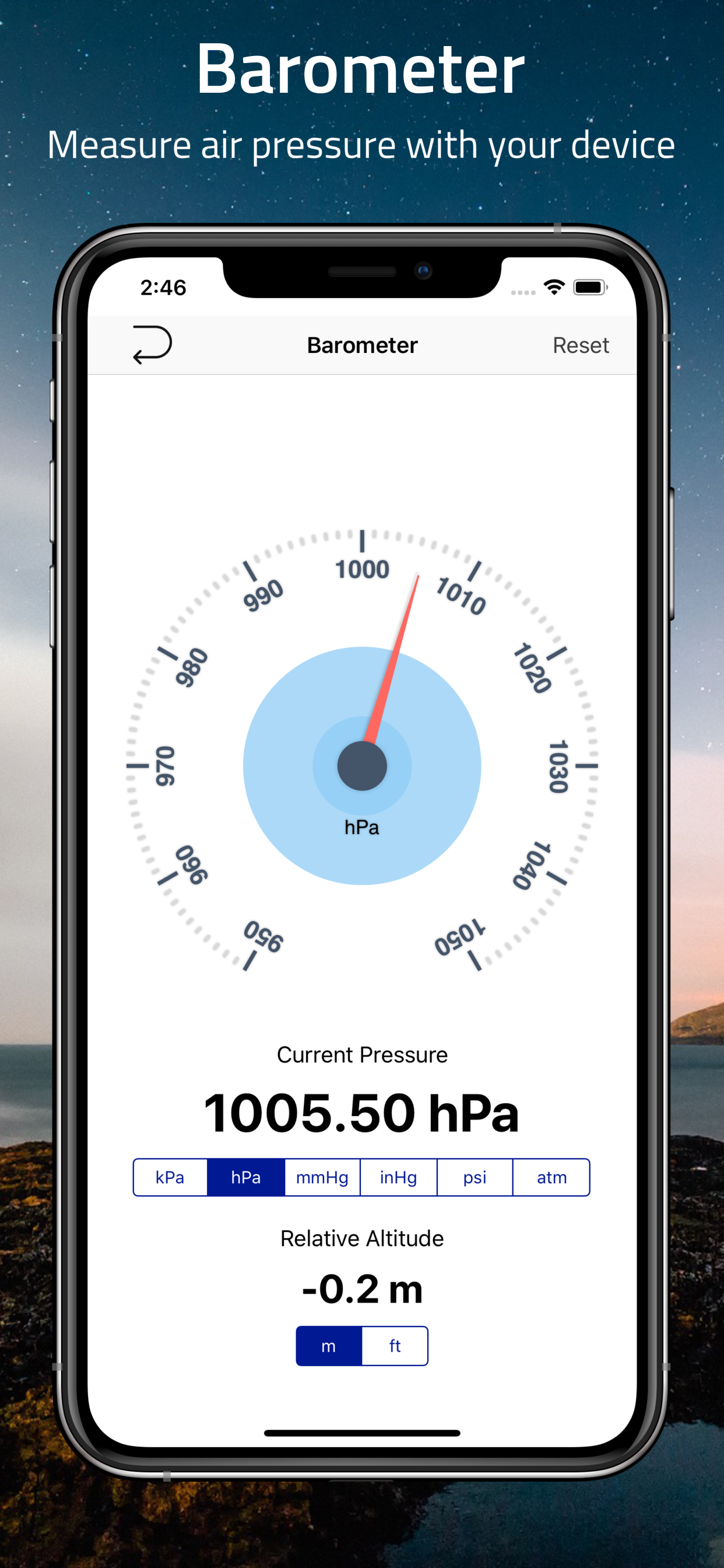
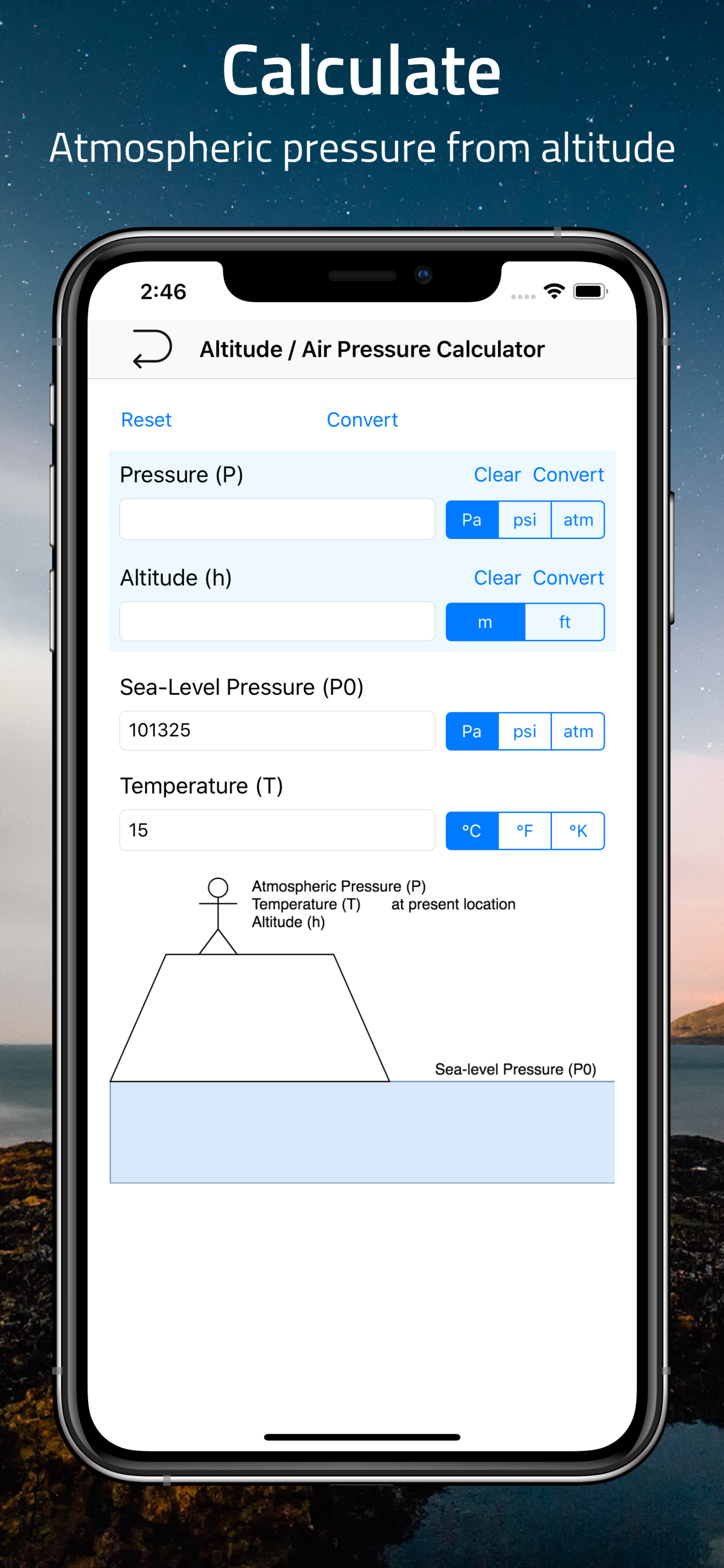
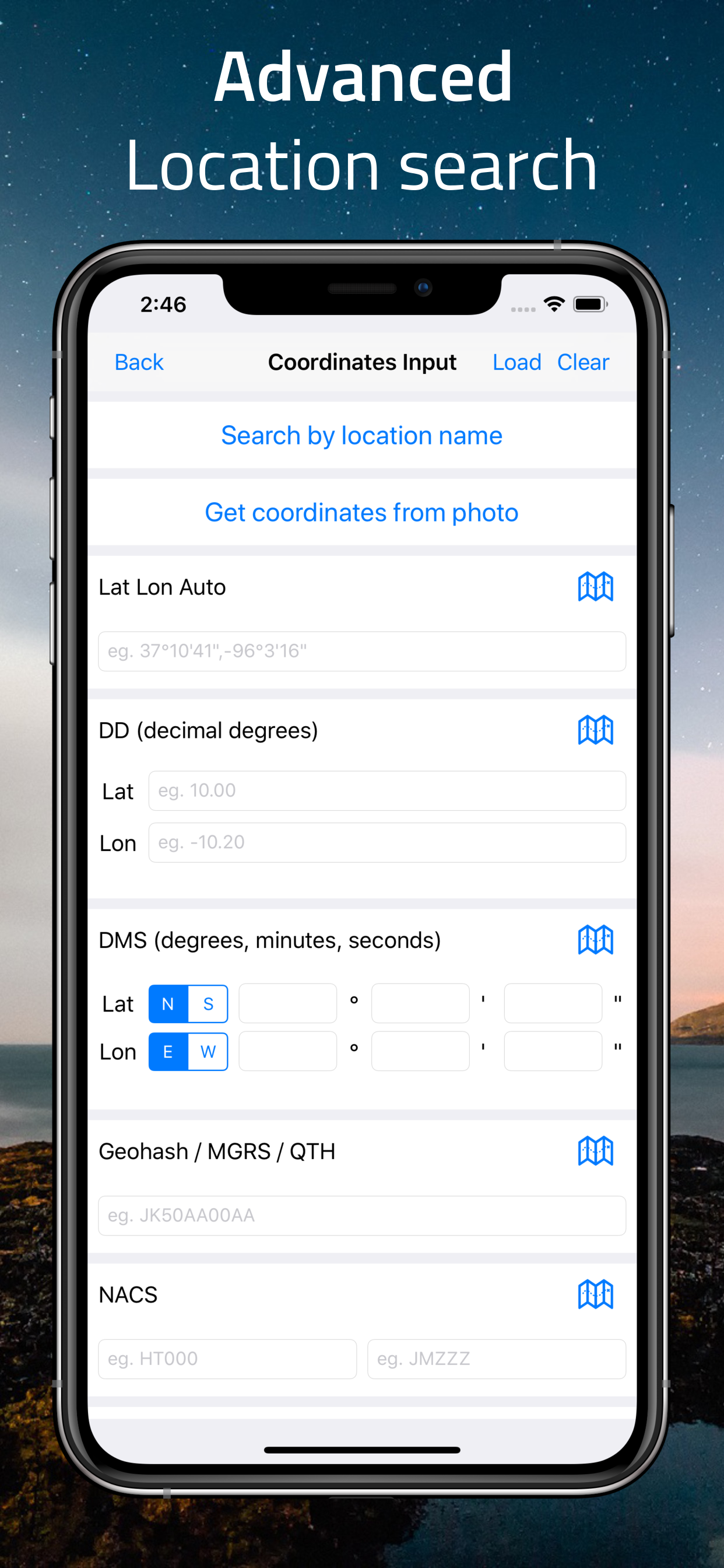
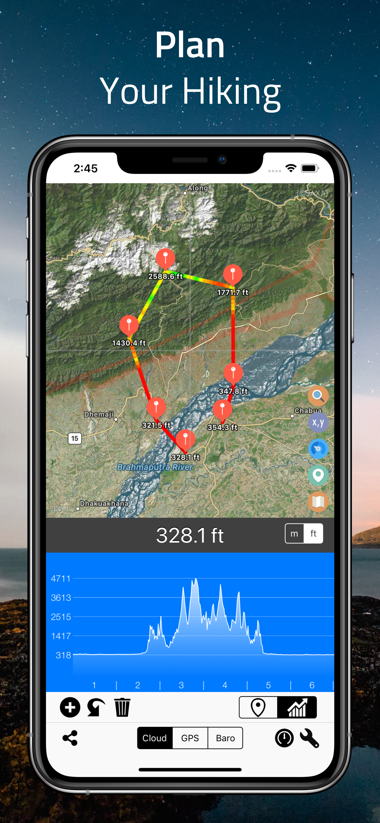
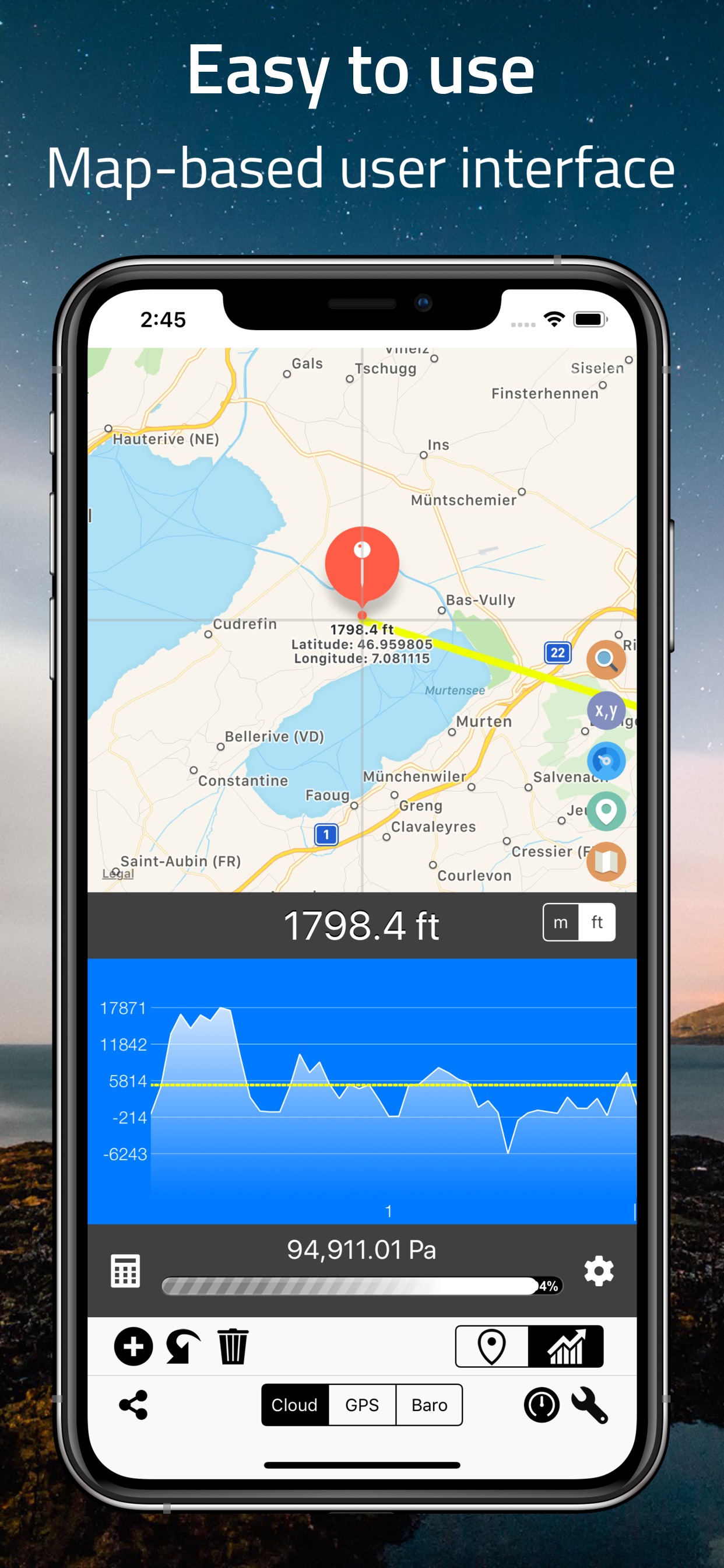
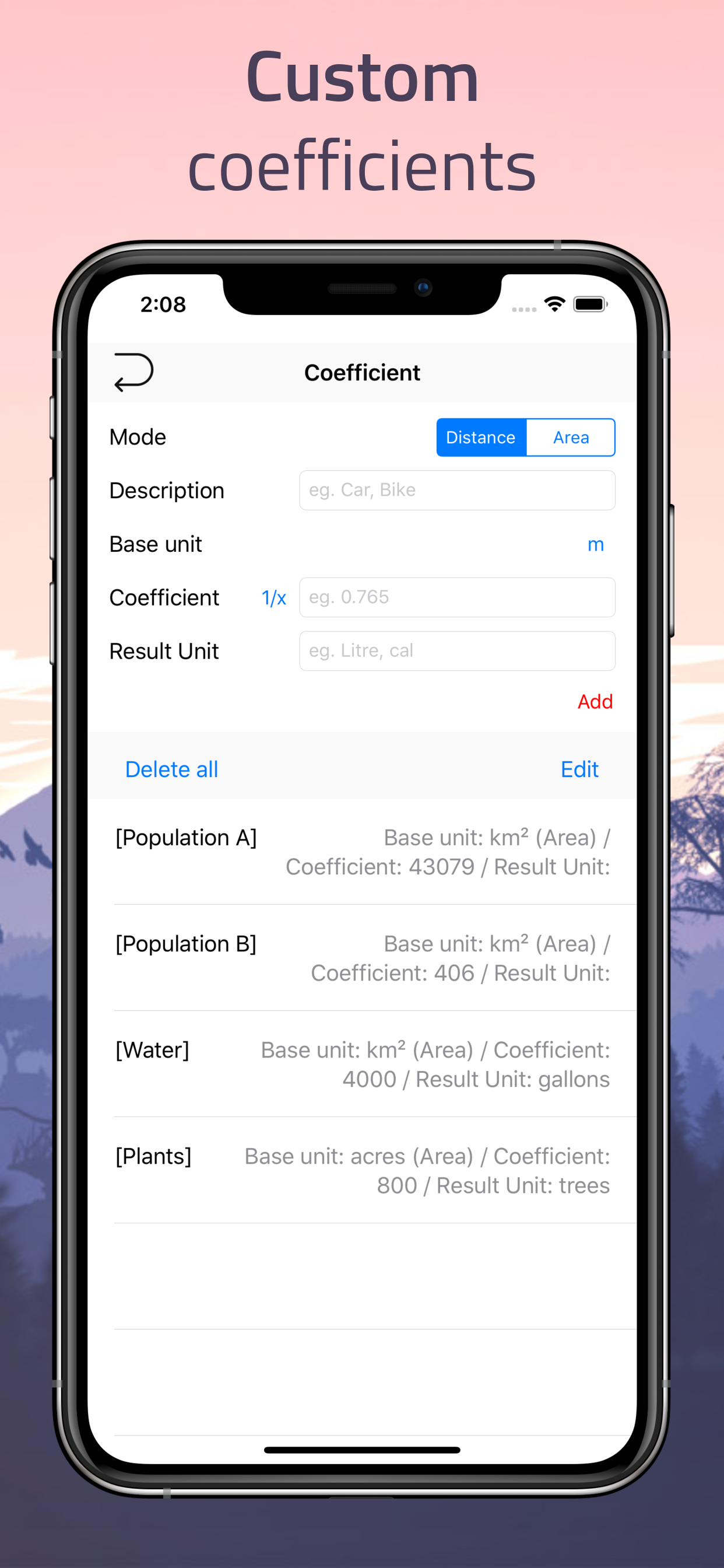
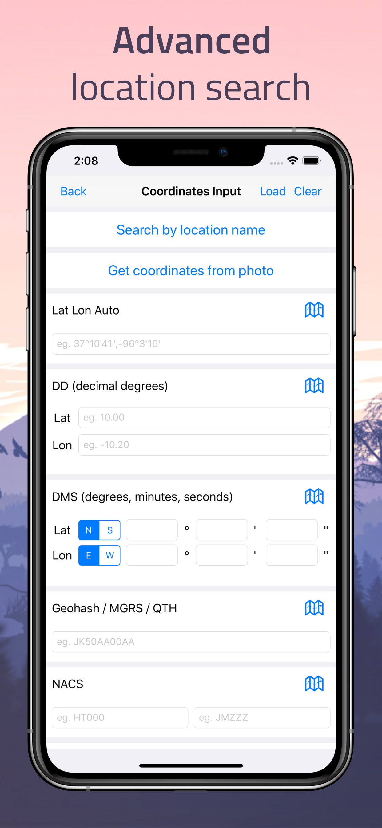
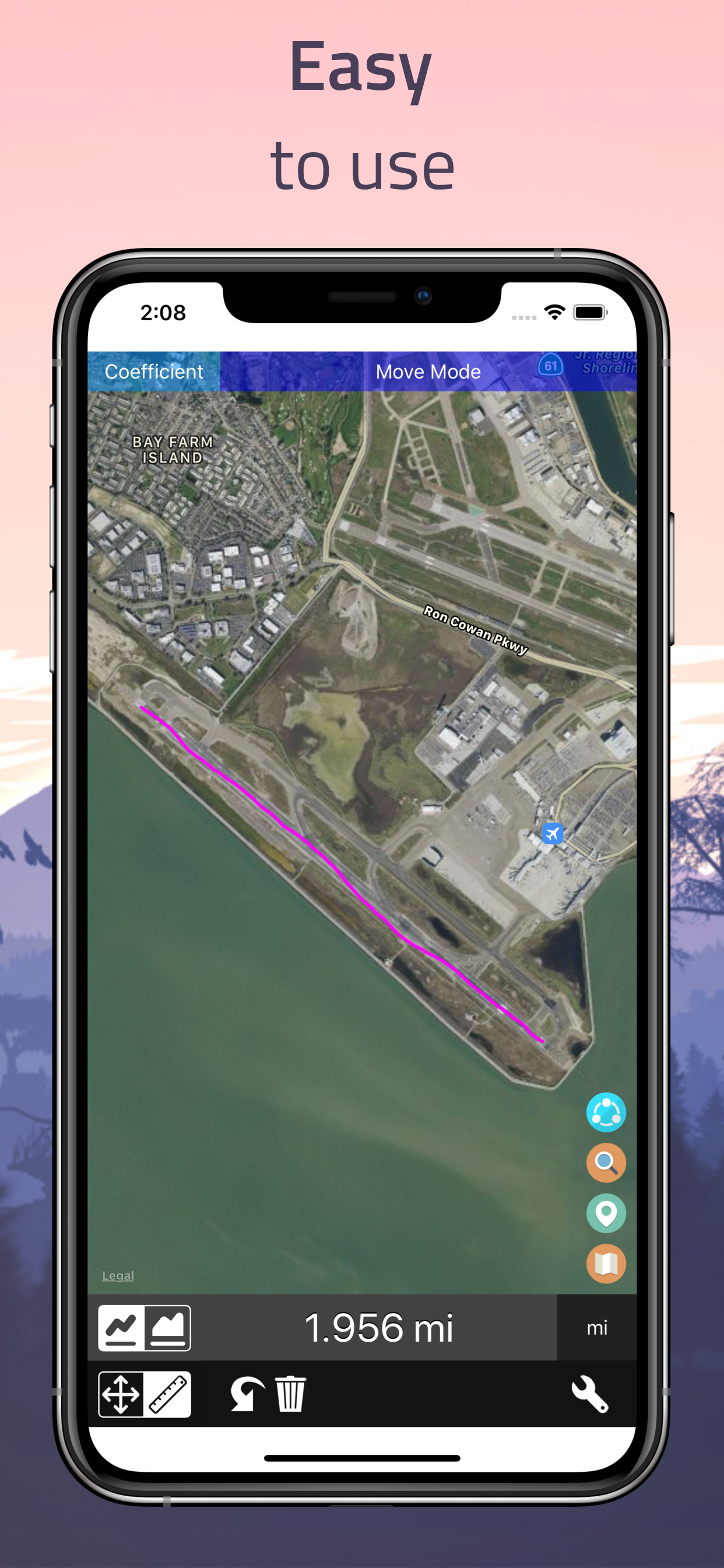
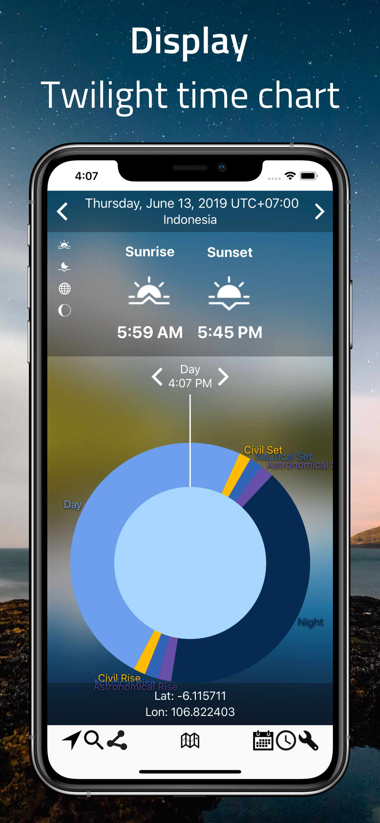
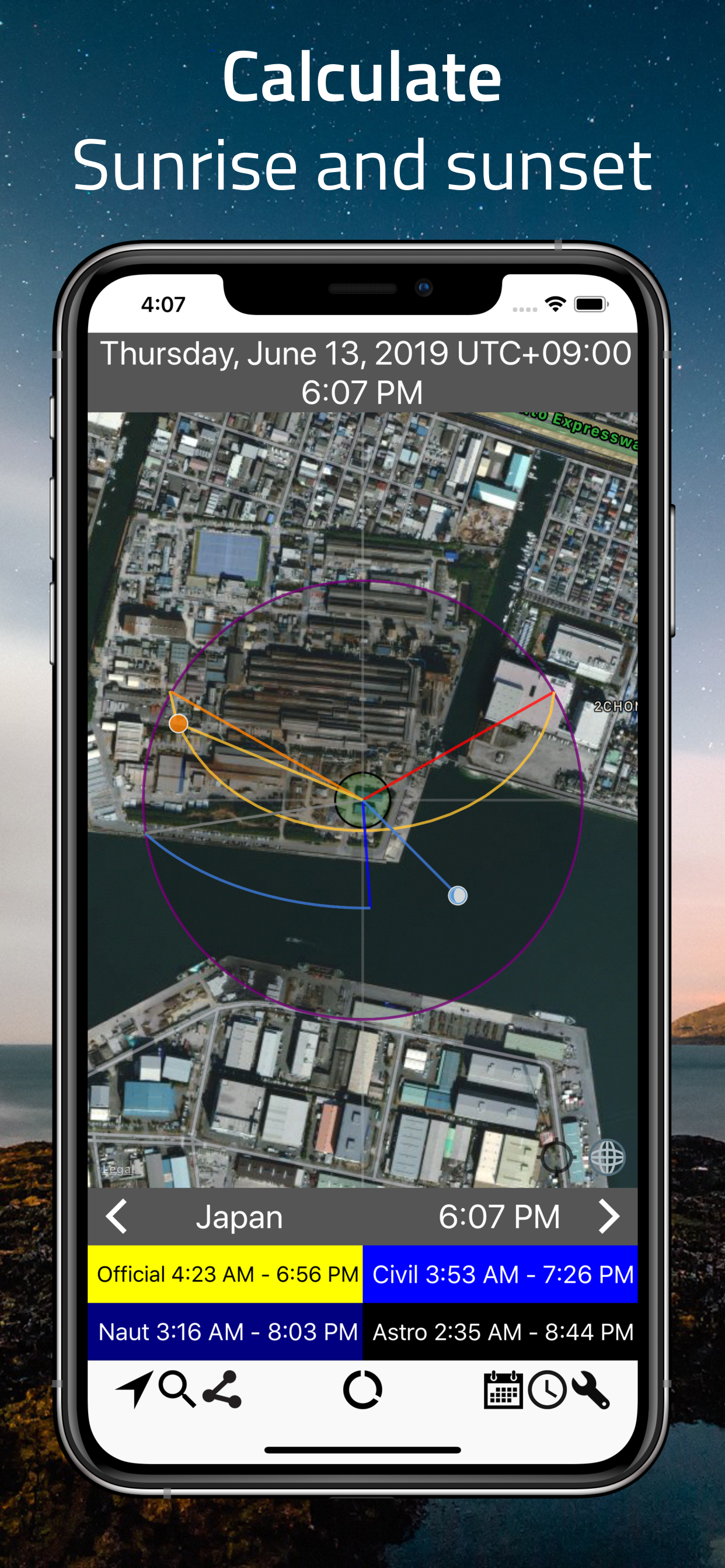
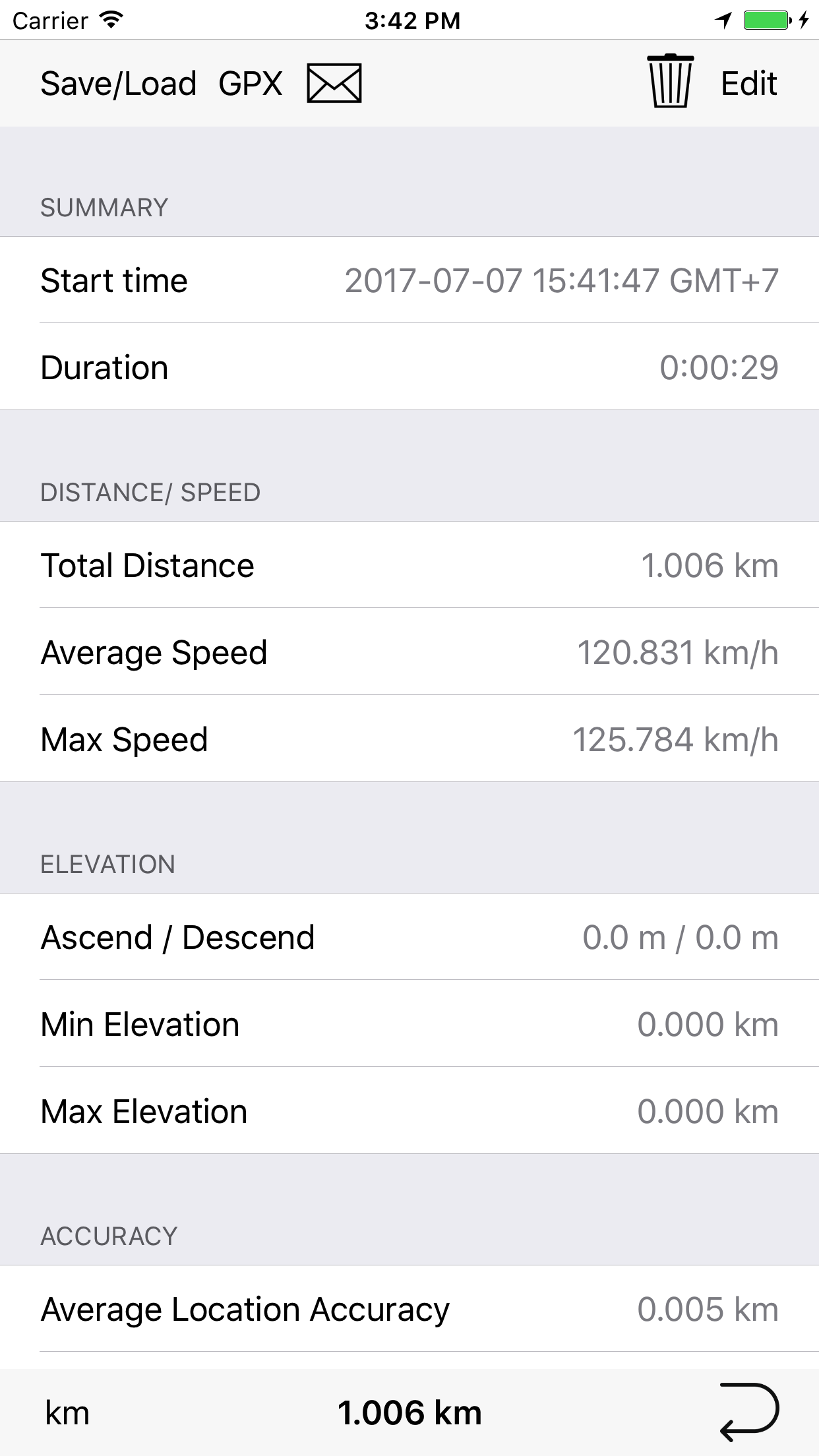
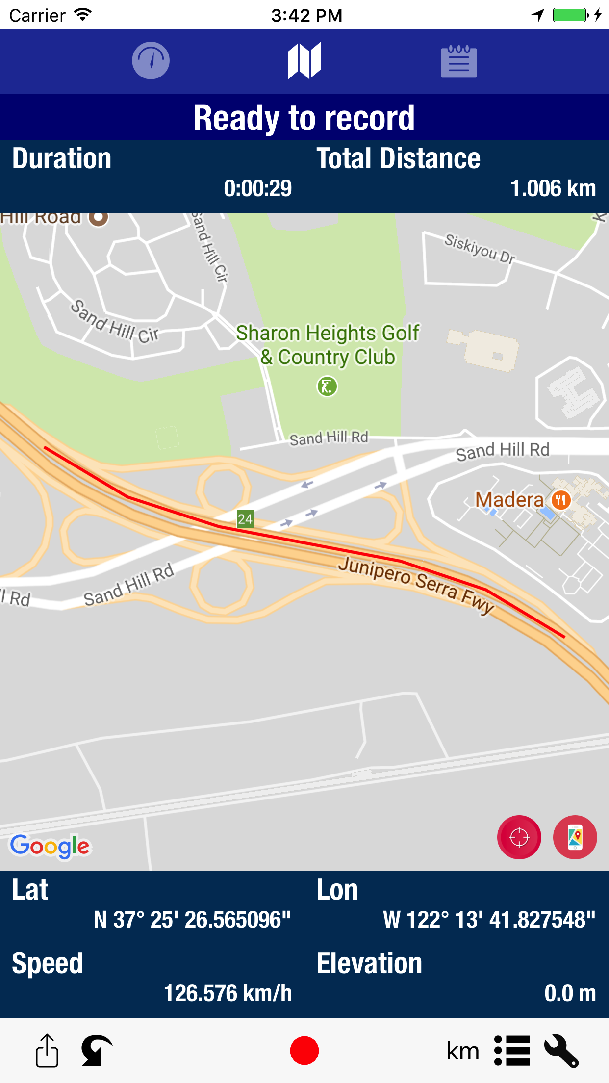
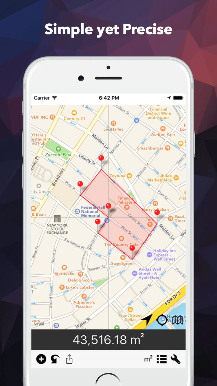
Simple and easy to use map app. To do various task ranging from determining coordinates, elevations, distance, and much more.

Tools

Ranging from barcode reader to random word generator

Localized apps

View commodities price and much more

Trusted by 

what3words-logo-horizontal-WHITE-styleguide-PNG-1.png

And More….


Geographic data analysis tools on your mobile device. For free

Empower your map data analysis


Coordinates

Simple and easy to use app for determining geolocation coordinates of various formats. 

Just find your location in the center of the screen (where the grey-line intersects), and result will appear instantly. Search location by name of place, city, state, or country.

It also supports several coordinate formats and systems, such as the Universal Transverse Mercator coordinate system (UTM), Military grid reference system (MGRS), and World Geographic Reference System (Georef) and many more.


Elevation

Know your current elevation, altitude, height above sea level easy with this app.

This elevation tool allows you to see elevation all locations on the surface of the earth. You can simply move maps around to get the data, or type in address and location you want. You can also zoom into the map and touch to find the elevation of a point.

Get elevation data from cloud, build-in GPS, or build-in barometer in your device. Use the app as standalone barometer, and much more!


Distance

Draw to measure distance along the map, made easy with this app. Now with area measurement and custom coefficients.

By simply dragging on the screen. Draw a route on the map to find its distance. Magnifier will help you make precise drawing and measurement.


sunclock2.png
 

SunMap

Help you plan outdoor photography with this free app.

Want to know Sunrise, Sunset, Moonrise and Moonset times? This app can helps you. It can show visualized Sun/Moon-Rise/Set time. Exact location of Sun/Moon and upcoming twilight of anytime anywhere. All displayed in a beautiful time-chart style and on an interactive map that contains riches of information. Pick any time and date to see how different Sunrise/Sunset times change during different season.


GeoLOGGEr

GeoLogger is GPS multi-tool for your devices.

Speedometer / Location data viewer:
GeoLogger allows you to see your phone / tablet's GPS information such as speed, elevation, direction (bearing), coordinates (latitude/longitude) in head on display format. You can use this app to confirm true speed / elevation while riding, flying, sailing, cycling, running, etc. 

Recording/Tracking/Logger:
GeoLogger also allows recording of your trip information including speed, elevation. Record your progress of your activities such as riding, flying, sailing, cycling, running, etc. See your speed, elevation, and elevation in line graph. You could manually edit trip information via in-app text editor. or export trip information to .gpx file.


Also available...

Coordinates

Easy to use app for determining coordinates of various formats. 

Elevation

Know your current elevation, altitude, height above sea level easy with this app. 

Distance

Draw to measure area and/or distance along the map, made easy with this app.


BlastSim

See an outcome if nuclear weapon ever goes off in your city

Addressfinder

Quick Address lookup on a map. Find full addresses, Zip code/Post code number

DIStancepinner

Find the distance between points on the map. Useful for route planning, finding shortest distance, traveling, and more.


Area & Distance

Measuring area and distance on the map, made easy with this app.

Sunmap

Show visualized Sun/Moon-Rise/Set time. Exact location of Sun/Moon and upcoming twilight.

GeoLogger

Read, Record, and Track your trip. See GPS data such as, elevation, speed, direction of your current location.


Free and easy to use application

Extend your device capabilities

iPhone Xs Max-01Barcode - Batch_framed.png
0x0ss.jpg
iPhone Xs Max-01InspireMe - Random_framed.png

Barcodeeasy

Simple barcode reader/generator that supported most format available. Localised to over 20 languages.

#Nowplaying

Tweet your favorite music. Share your favorite tunes to Twitter, Facebook and many more.

Inspireme

Random word generator that could spark your idea. Useful tools for brainstorming. Support multiple languages.


and much more...


Designed to serve locals information need

Commodities price always available


ThaiGOLDprice

One of the most popular gold price app in Thailand.

ThaiOIlPRICE

The first Thai petrol price app with unique design